


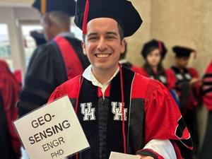
Engineers at the University of Houston have developed an innovative artificial intelligence framework that transforms historical flood insurance maps into digital datasets, significantly enhancing the understanding of flooding risks in the Houston area. This research, led by Francisco Haces-Garcia, who earned his doctorate in engineering at the University in 2026, reveals critical insights into how flood hazards have evolved over time and where future risks may arise.
The project focuses on extracting and georeferencing decades of flood hazard data from historical Flood Insurance Rate Maps (FIRMs). By converting these paper records into high-accuracy digital formats, the research team provides a vital tool for researchers, urban planners, and policymakers to monitor shifting flood risks and make informed decisions regarding infrastructure, development, and disaster preparedness. “The resulting dataset of longitudinal flood evolution can now be used to understand how geophysical drivers exacerbated flooding,” Haces-Garcia noted. He emphasized that combining this data with other variables, such as population growth and critical lifeline services, can help formulate strategies to mitigate vulnerabilities and enhance recovery efforts from floods.
Utilizing data spanning from the 1970s to 2025, the team conducted case studies in three distinct areas within Greater Houston: Meyerland, Fifth Ward/Kashmere Gardens, and Cypress, near Bridgeland. The analysis revealed significant variations in flood risks across these locations, underscoring the importance of their newly developed dataset.
In Meyerland, despite substantial investments in flood control measures, the 100-year floodplain has notably expanded, a development attributed to rapid urbanization and increased impervious surfaces that heighten runoff. Conversely, in the Fifth Ward and Kashmere Gardens, flood risk has also increased, driven by a combination of drainage modifications, evolving mapping methods, as well as intensified rainfall and development.
However, the case study in Cypress showed a reduction in floodplain extent, likely due to the implementation of newer regulations and improvements in drainage systems. Nonetheless, nearby studies suggest that flood risk in the area remains complicated, influenced by factors such as land subsidence.
This research not only reveals critical changes in Houston’s flood landscape but holds broader implications for urban planning and policy-making in flood-prone regions nationwide. The ability to analyze historical flood trends provides a powerful tool for understanding risks in rapidly urbanizing areas, particularly as climate change continues to impact weather patterns and flood occurrences.
The research team also includes notable engineers such as Craig Glennie, the Hugh Roy and Lillie Cranz Cullen Distinguished University Chair of Civil and Environmental Engineering and director of the National Center for Airborne Laser Mapping; Hanadi Rifai, Moores Professor of Civil and Environmental Engineering; and Vedhus Hoskere, Kaspar J. Willam Assistant Professor of Civil and Environmental Engineering. Their collaborative efforts have culminated in a paper titled “The longitudinal assessment of flood hazard in cities: Unlocking the floodplain record of Houston, TX, USA,” published in the Journal of Hydrology: Regional Studies on April 1, 2026.
As urban areas like Houston continue to grow, the integration of advanced AI techniques into flood risk analysis may prove essential in developing sustainable urban environments capable of withstanding the challenges posed by climate-related flooding. The findings from this research could be pivotal in shaping future infrastructure and disaster management strategies across the region and beyond.
See also Friendly AI Chatbots 30% Less Accurate, 40% More Likely to Support Conspiracy Theories, Study Finds
 Generative AI Increases Cyber Risks in Machine Learning, Warns Heriot-Watt Study
 Google Unveils TurboQuant: AI Models Use 6x Less Memory Without Performance Loss
 IARPA Launches Five AI Research Programs to Enhance Intelligence Capabilities
 OpenAI Reveals Explainable AI for Detecting Machine-Generated Music in New Study